
{{product.productLabel}} {{product.model}}
{{#if product.featureValues}}{{product.productPrice.formattedPrice}} {{#if product.productPrice.priceType === "PRICE_RANGE" }} - {{product.productPrice.formattedPriceMax}} {{/if}}
{{#each product.specData:i}}
{{name}}: {{value}}
{{#i!=(product.specData.length-1)}}
{{/end}}
{{/each}}
{{{product.idpText}}}
... Overview
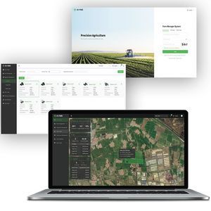
Hi-FMS is an all-in-one farm management platform for agricultural professionals to plan, monitor and optimize field operations. The system provides web-based real-time access to equipment operation data, trajectory data and task status ...

... All available information is made accessible on an individual platform, clearly laid out and perfectly adapted to the user's needs. •Overview of water consumption live and in history (including flow calculation for each water network node and each ...
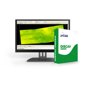
... •Discav Green is a software dedicated to earth movement in agriculture for reclamation, irrigation and drainage. •It allows the import of the grid survey or the import directly from the GPS system •Calculate the average ...
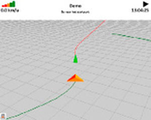
... trees. You also enjoy the advantages of working with GPS: straight lines, tidy work and less overlap. If you choose an X-pert package from Precision Makers, you choose the most advanced software and GPS ...

... of AquaCheckWEB: •Web-based, thus no software to install and available 24 hours a day, 7 days a week. •View and manage multi-layer soil moisture and temperature dynamics for the entire root zone. •Probe GPS location ...

... and maps; aerial . - images, ALKIS, soil type maps, etc. . - Import and export in Shape format . - Integration of various GPS receivers . - Display the accuracy and number of satellites . - RTK and Mobile RTK . - SAPOS ...
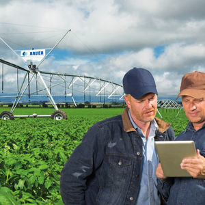
Water is a precious resource, which needs to be conserved. With regulators applying pressure on an array of ever stricter regulations regarding water usage, and environmental protection increasing worldwide, Bauer saw a need to develop ...
the best suppliers