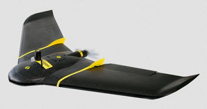
{{product.productLabel}} {{product.model}}
{{#if product.featureValues}}{{product.productPrice.formattedPrice}} {{#if product.productPrice.priceType === "PRICE_RANGE" }} - {{product.productPrice.formattedPriceMax}} {{/if}}
{{#each product.specData:i}}
{{name}}: {{value}}
{{#i!=(product.specData.length-1)}}
{{/end}}
{{/each}}
{{{product.idpText}}}
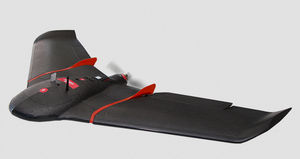
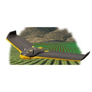
... メリット SKYCROPSを使用すると、光学、マルチスペクトル、熱、LiDARの定期的またはプログラム的なキャプチャーにより、作物の最新情報、統計レポート、地球物理学的分析を得ることができる別の診断ツールを手に入れることができます。 何を測定するのか? 温度画像(温度マップ、高解像度、林業、農業(ウォーターストレス マルチスペクトル(作物の健康、栄養状態、灌漑問題、菌類、昆虫、病気 OPTICS (RGB) (写真と3Dマップ、レベルカーブ、2D/3D計測、点群、デジタル標高モデル) LIDAR(3Dモデリング、土壌タイプ判定、収量予測、作物分析、圃場管理、作物被害 ...