
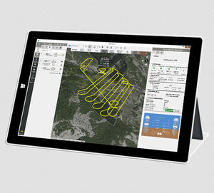
{{product.productLabel}} {{product.model}}
{{#if product.featureValues}}{{product.productPrice.formattedPrice}} {{#if product.productPrice.priceType === "PRICE_RANGE" }} - {{product.productPrice.formattedPriceMax}} {{/if}}
{{#each product.specData:i}}
{{name}}: {{value}}
{{#i!=(product.specData.length-1)}}
{{/end}}
{{/each}}
{{{product.idpText}}}
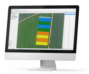
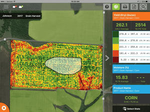
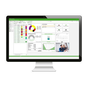
... yield comparison reports. Do More In-Depth Analysis AgFiniti integrates with Ag Leader’s robust analysis platform, SMS Software. Data is automatically synced to SMS for further analysis and can easily be shared back to displays through ...
Ag Leader
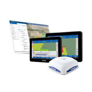
... manage your farm operations with Trimble Ag Software, with specific tools and workflows for pre‑season planning, in‑season execution, and post-season analysis. Benefits and performance Trimble’s software solutions ...
Trimble Agriculture

Designed for farmers, dealers, agronomists, and input suppliers who need to gather and consolidate key operational information, the Topcon Agriculture Platform (TAP) brings connectivity to every phase of the farming cycle. TAP is a simple tool to organize, ...
The DJI SmartFarm can instantly generate high-definition images of farmland and orchards, as well as analyze crop growth with total clarity. It enables convenient management of digitalized agricultural information by providing guidance for the automatic ...
... Support up to 60° IMU tilt compensation Support all survey modes, including Static, PPK and RTK Support Surface Stake, Mapping Survey and etc. to serve various survey tasks Support CAD import and directly use for stake out operations Support ...

... It is a powerful data collection software,supporting the newest and most advanced GNSS hardware on the market ...
... Overview
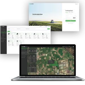
Hi-FMS is an all-in-one farm management platform for agricultural professionals to plan, monitor and optimize field operations. The system provides web-based real-time access to equipment operation data, trajectory data and task status ...
... Hemisphere GNSS’ new OEM application software and hardware for building your agriculture guidance and control systems. Hemisphere’s industry-leading technology empowers your applications using core hardware and software ...
... Let FarmLab help you build and leverage your client data for productivity, sustainability and profitability Easier Sample Collection Collect soil, plant and water samples with FarmLab’s mobile app or access a network of samplers to provide the service ...
... spray drones, tractors, and field sprayers. Create and use prescription maps directly with your machinery - no third party software needed In-field or In-office Rapidly create maps without leaving the field (offline available), ...
... The new agricultural software for your business success. Our new farm management system NEXT Farming Pro is the best choice for your professional requirements. NEXT Farming Pro is characterized by its very high compatibility with other ...

... All available information is made accessible on an individual platform, clearly laid out and perfectly adapted to the user's needs. •Overview of water consumption live and in history (including flow calculation for each water network node and each ...
... AgMaps is the new agricultural area meter developed for Windows operating systems. •Management and storage of your farmland •Recording in manual mode or every 2.5, 10 seconds •The survey is displayed in real time on the screen of a tablet or a normal ...
s.c.s. survey cad system

... Augmenta Web Platform Observe operational details through the eyes of the System. Health index maps, Crop input statistics, 4K Snapshots of damaged areas and more are available through Augmenta Web Portal. Real time monitoring of tractor position, speed ...
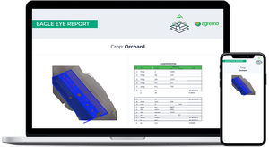
... The benefits of Agremo Eagle Eye Report Agremo Eagle Eye Report is designed for Ag professionals to help them create a visual plan of their field by determining the size of field areas, identifying problematic areas, arable areas, and more. With an eagle ...

... NEXT Area SurveyingOFFICE With NEXT Area SurveyingOFFICE, boundary stones can be searched for and areas surveyed without surveyors. Landscape elements are documented for the yield, and cutting data breakdowns are mapped graphically. The use of digital ...
... view of the entire field rather than readings from isolated disparate locations. With Manna’s affordable and user-friendly software, growers get dynamic, crop and site-specific irrigation recommendations anywhere and anytime. Benefits Precise ...
... flight management (or ground station) software defines your experience—if this is complicated or confusing, professional drone operation can quickly become a chore. eMotion 3 is different: it’s advanced, scalable software ...
senseFly

... The platform that you have been looking for all the power of digital agriculture in one single app WHY USE XFARM Created by Farmers for farmers xFarm is born out of the need to be able to exploit the advantages of digital means in agriculture, in ...
... Preparation of georeferenced field plans for use throughout the entire cultivation process With WINTERSTEIGER MiniGIS 2, you can plan and position your field trials in the field in advance in a manner that is accurate to the centimeter in consideration ...
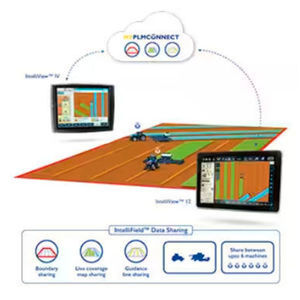
IntelliField™ is an intuitive feature that allows multiple vehicles to work in the same field / operation while simultaneously sharing boundaries, straight guidance lines, and real-time coverage data. Customers running in this scenario will appreciate ...
NEW HOLLAND
... Crop gross weight mapping is a weighing system, which is based on an electronic belt scale. The system records yield differences within the field and documents the crop yields on a site-specific basis. Based on this data, a yield map ...

... Internet - wherever you are -Comprehensive compatibility of your HOLMER machine with third-party software (e.g. farmpilot) - so that existing administration software can continue to be used -In the event of a fault, ...
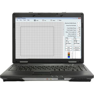
Map out each field location prior to the planting season and change population rates and plot lengths on the fly.
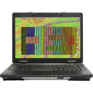
... ALMACO teamed up with Ag Leader Technology to bring you the latest in field mapping technology specific to the Seed Pro 360 planters. The Plot Prescription module provides you with 3-dimensional field layers including: soil type, fertilizer, ...
... The DYNAMIC SCAN system installed on the hydraulic equipments, measures the hardness or degree of compaction of each point of the soil and generates hardness maps in real time. This makes it possible to precisely analyze the needs of the soil and, by ...

... insight-based decisions. Coordination Create and assign tasks to autosteering kits for coordinated and streamlined workflow. Mapping Map out your boundaries FJD Connect with clicks of your mouse and get the acreage in no time. Task ...
the best suppliers