Mapping software precision agriculture
Add to favorites
Compare this product
fo_shop_gate_exact_title
Characteristics
- Function
- mapping
- Applications
- precision agriculture
Description
The benefits of Agremo Eagle Eye Report
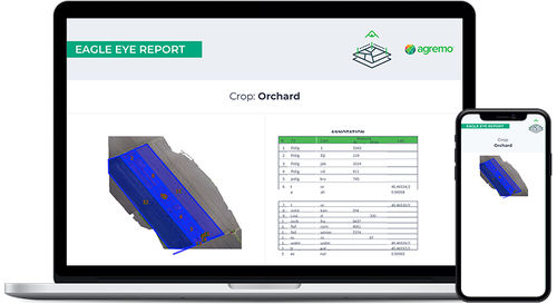
Agremo Eagle Eye Report is designed for Ag professionals to help them create a visual plan of their field by determining the size of field areas, identifying problematic areas, arable areas, and more. With an eagle eye report, you get a detailed list of all points of interest on your map with their latitude and longitude, which can include trees, rocks, irrigation systems, and other. It also allows you to precisely calculate the exact distance between specific points on your field, like the distance between roads, plants, rows, fields, etc.
The best time to apply Eagle Eye Report
One of the advantages of eagle view reports is the fact that they can be utilized throughout the year – regardless of the time in crop season, the possibility to visually depict points and field areas on the field map can help to optimize yields and save resources.
Supported CROPS
The report makes it possible to create a visual plan of the entire field that you plan to cultivate. As a result, all crops benefit from eagle view reports, including vegetables, plantation, forestry, and field crops.
Catalogs
No catalogs are available for this product.
See all of Agremo‘s catalogs*Prices are pre-tax. They exclude delivery charges and customs duties and do not include additional charges for installation or activation options. Prices are indicative only and may vary by country, with changes to the cost of raw materials and exchange rates.


