
- Farm Management
- Precision agriculture
- Satellite receiver
- Shanghai eSurvey GNSS Co., Ltd.
Satellite receiver eRTK10GNSSGLONASSGPS


Add to favorites
Compare this product
Characteristics
- Network
- GNSS, GPS, GLONASS, GALILEO, satellite
- Other characteristics
- precision agriculture, IP67
Description
AR Visual Stakeout: More Efficient Stakeout
There is no need to move the pole back and forth and rely on work experience during a stakeout. Follow the visual guide to precisely find the target stakeout point. Suitable for a non-experienced user and provides up to 50% more efficiency.
Max 60° Tilt Survey: A Different Way of Working
- Quickly measure accurate points while standing or walking without leveling the pole.
- Concentrate on where the pole tip needs to go, which is especially useful during a stakeout.
- Easily start a survey in environments that are hard to reach, such as building corners and slopes.
- No longer worry about the movement of the pole when measuring, provided that the pole tip is stationary.
Rugged Design
It is strongly made and capable of withstanding rough handling and no need to worry about variety tough environments.
Multi-Constellation and Multi-Frequency
With 1408 channels of GNSS tracking, it provides stable and reliable accuracy. All GNSS signals come with the standard including GPS, BDS, GLONASS, Galileo, QZSS, NavIC, SBAS and L-Band.
Light Weight & Compact Design
The compact design of the eRTK10 makes it a small size and lightweight GNSS receiver, it is easy to carry around by users without getting tired.
Web UI
It allows users to view position status, set up working mode, download data, and update firmware from the Web user interface with any smart phone, tablet, or PC.
Technical Specifications / Features
- Product: eRTK10
- Type: AR Visual Stakeout GNSS Receiver
- Brand: eSurvey GNSS
- Visual AR stakeout for immersive 3D stakeout in real working environments
- 60° inclination IMU function
- Internal radio (Rx only)
- 1408 GNSS tracking channels
- Supports GPS, BDS, GLONASS, Galileo, QZSS, NavIC, SBAS, L-Band
- Rugged, compact, and lightweight design
- Web UI for configuration and data management
VIDEO
Catalogs
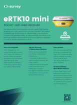
eRTK10 mini
2 Pages
Other Shanghai eSurvey GNSS Co., Ltd. products
Integrated GNSS Systems


Related Searches
- GNSS receiver
- Digital control unit
- Guidance system
- GPS receiver
- GLONASS receiver
- GALILEO receiver
- RTK receiver
- Automated guidance system
- Precision agriculture receiver
- Farm machinery antenna
- Tractor guidance system
- GNSS guidance system
- Agriculture machine guidance system
- Wireless receiver
- GNSS antenna
- RTK guidance system
- GPS guidance system
- 4G receiver
- Satellite receiver
- Bluetooth receiver
*Prices are pre-tax. They exclude delivery charges and customs duties and do not include additional charges for installation or activation options. Prices are indicative only and may vary by country, with changes to the cost of raw materials and exchange rates.